
Art
The world map: three maps, not one
Elyndor is spread across three layers and each has its own drawn map. Here are the surface, the sky and the underdeep — and what they are for besides looking good.
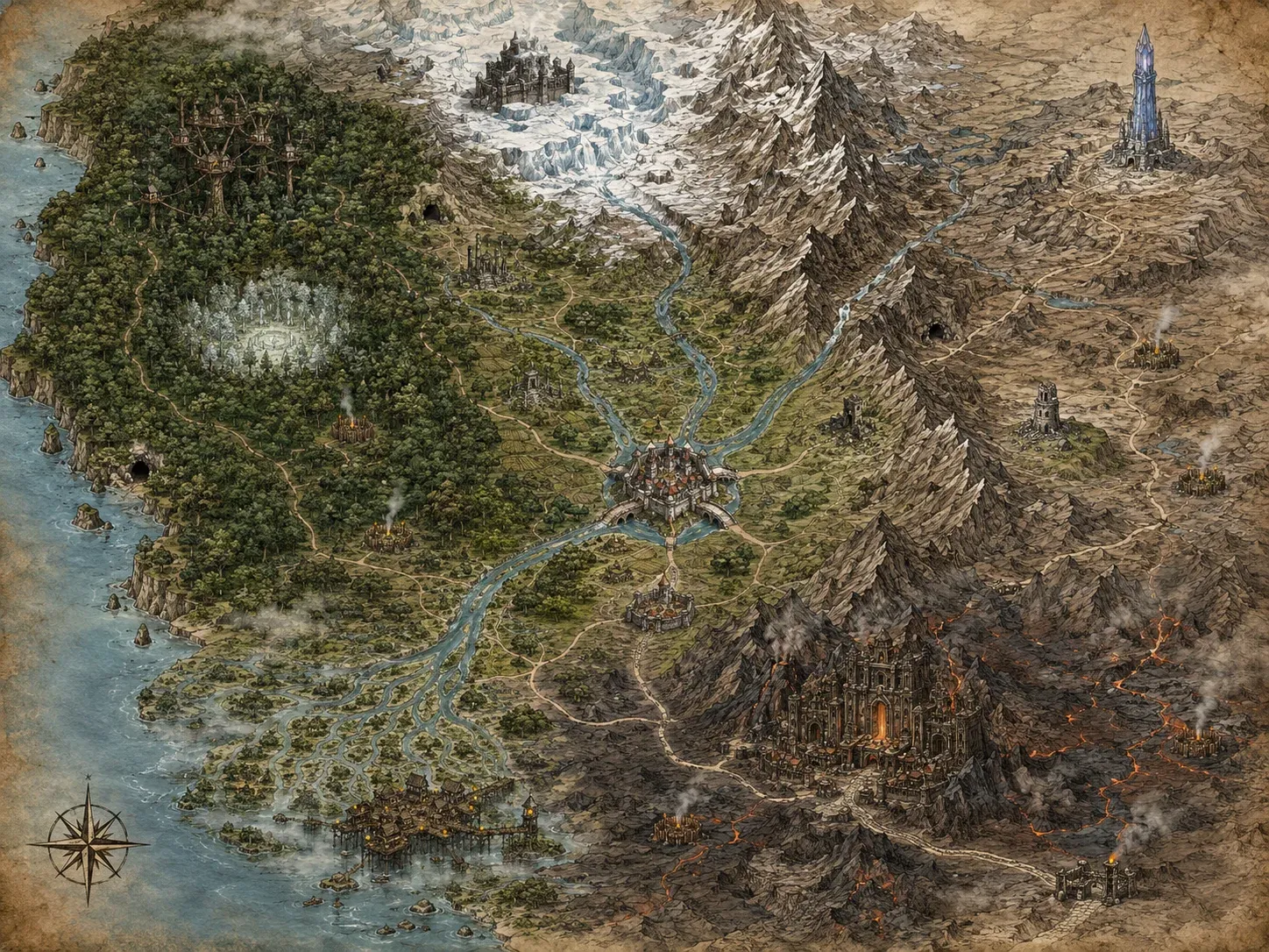
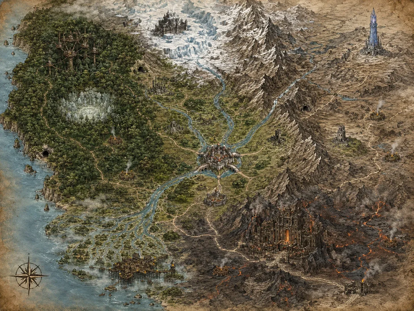
A world spread across three layers does not fit on one map. It needs three, and they have to be readable together.
The surface
This is the layer you travel most and the first one drawn. Forests to the west, glacier to the north, a range that splits the continent, a volcanic region to the south-east, marshes and deltas to the south-west, and at the centre a city of bridges where the roads converge.
The sky
Up there is no solid ground: there are islands. Fragments of continent suspended between clouds, joined by chains and walkways, with ruins and towers on top.
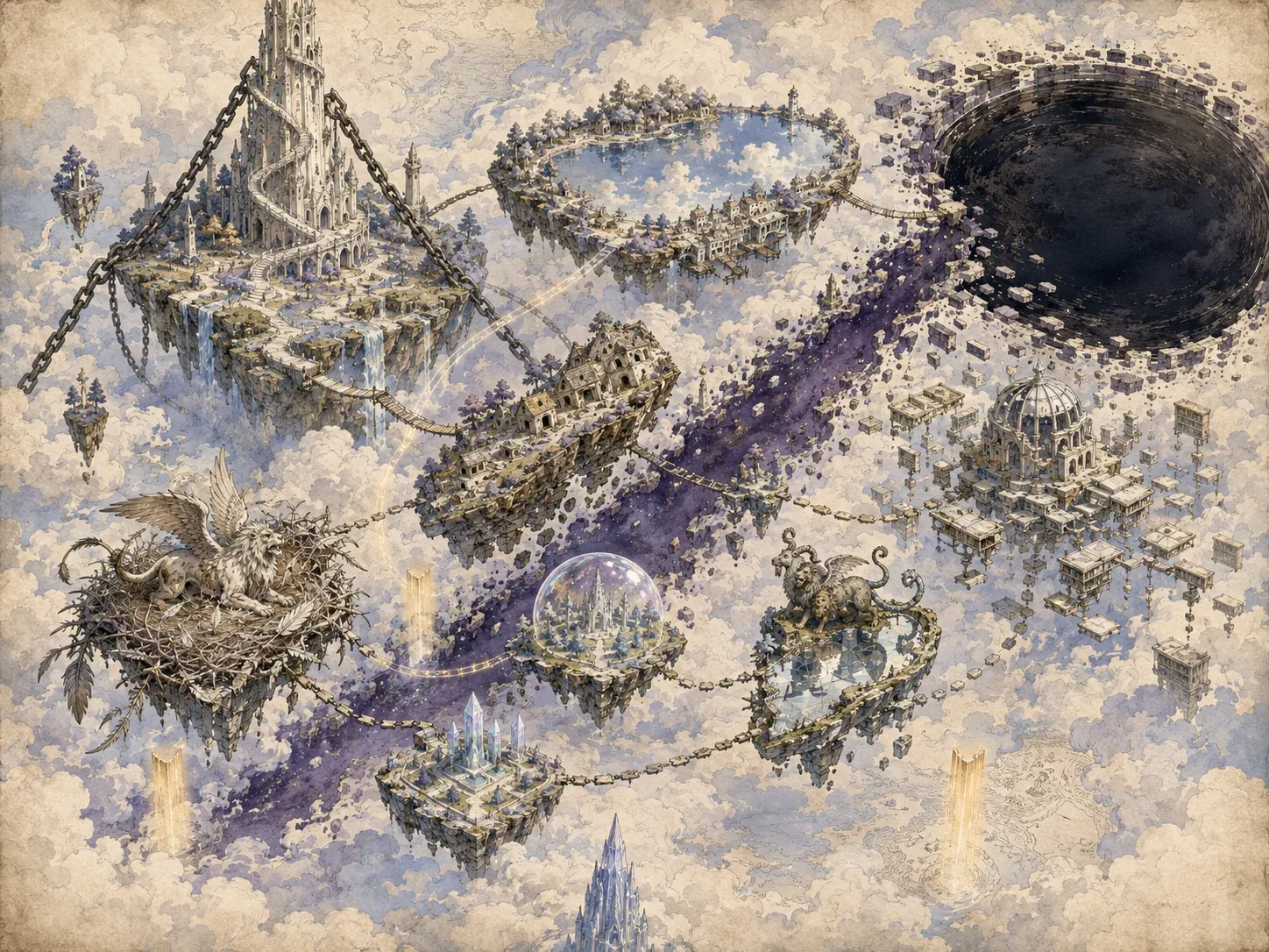
It is the layer fewest people have seen and the one most lied about, and the map is drawn so you feel it: a lot of white, a lot of cloud, and connections more fragile than anywhere else.
The underdeep
And below, the opposite: no emptiness at all. Everything is rock, and the world organises itself into cavities connected like cells.
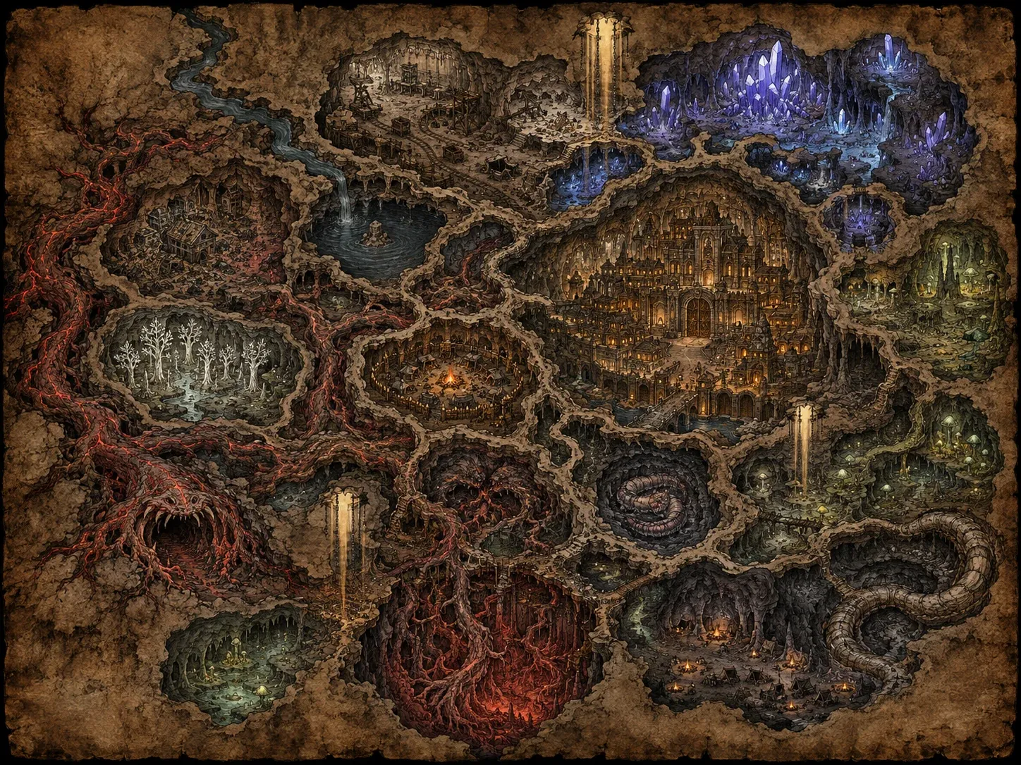
A city carved at the centre, crystal caves, enormous roots, lakes where there should be no water. Scale reads backwards here: what is a valley on the surface is a single chamber down below.
What they are for, besides looking good
Maps like these could be pure decoration. These are not: they are the planning tool.
Every place you see drawn also exists as a node with its data — which region it belongs to, what it connects to, what you need to get there — and the paths in the drawing are the game’s actual routes. When I wrote in the citadel entry that it had to be redesigned because it only had one exit, the problem showed up here: on the map that place is a junction, and a junction with one gate is not a junction.
The playable world these three maps delimit adds up to 51 points of interest joined by 46 routes, plus thirteen mini-dungeons, nine hunting grounds and six abandoned villages. The target is 22-32 hours of main story and 40-60 to see it all.
What I take from it
Drawing the world before building it sounds like a waste of time, and it is exactly the opposite: it is what stops you discovering in chapter twelve that two regions which need to be close sit on opposite corners of the continent.
The map does not illustrate the game. The map is the game’s blueprint, and it just happens to be framable too.